Aerial & Drone Photography
Overhead and elevated imagery that shows the lot, the roofline, the surroundings and the water — everything ground-level photos physically cannot capture.
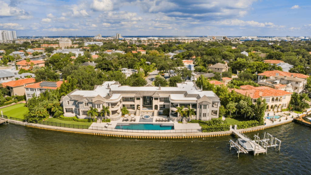
Aerial photography is where this business started, and it answers the questions a buyer cannot resolve from interior photos. How big is the lot? Where does the property sit relative to the water? What is next door? How much yard is actually behind the house? An elevated frame settles all of it in a single image.
Aerial coverage is especially valuable in the Tampa Bay area, where waterfront access, canal frontage, dock placement, acreage and proximity to the bay are often the reason a property is priced where it is. A ground-level photo of a back yard cannot show a boat lift, a canal running to open water, or a preserve behind the fence line — an overhead frame shows all three at once.
Aerials also work hard for land listings, new construction, larger acreage, and commercial property, where the shape and context of the parcel is the product being sold.
Who it is for
Waterfront and acreage listings, land and lot sales, new construction, commercial property, and any listing where location and lot size are the selling point.
What to expect
Drone work depends on weather and airspace. Sustained wind, rain, or restricted airspace can require rescheduling the aerial portion of a shoot, and that call is always made in the interest of a safe, legal flight.
Other services
Listing Photography
The core MLS-ready shoot: bright, straight, properly exposed interiors and exteriors that represent the property honestly and make buyers stop scrolling.
Twilight
Dusk exteriors shot in the short window when the sky still has color and the house lights are on — consistently among the most clicked images on a listing.
Video
A moving tour that carries a viewer through the property in the order they would actually walk it, built for listing pages and social.
3D Tours & Floor Plans
An interactive walkthrough a buyer can navigate themselves, plus a measured floor plan that answers the layout questions photos leave open.
Virtual Staging
Digitally furnishing empty rooms so buyers can read scale and purpose, at a fraction of the cost of physically staging a vacant property.